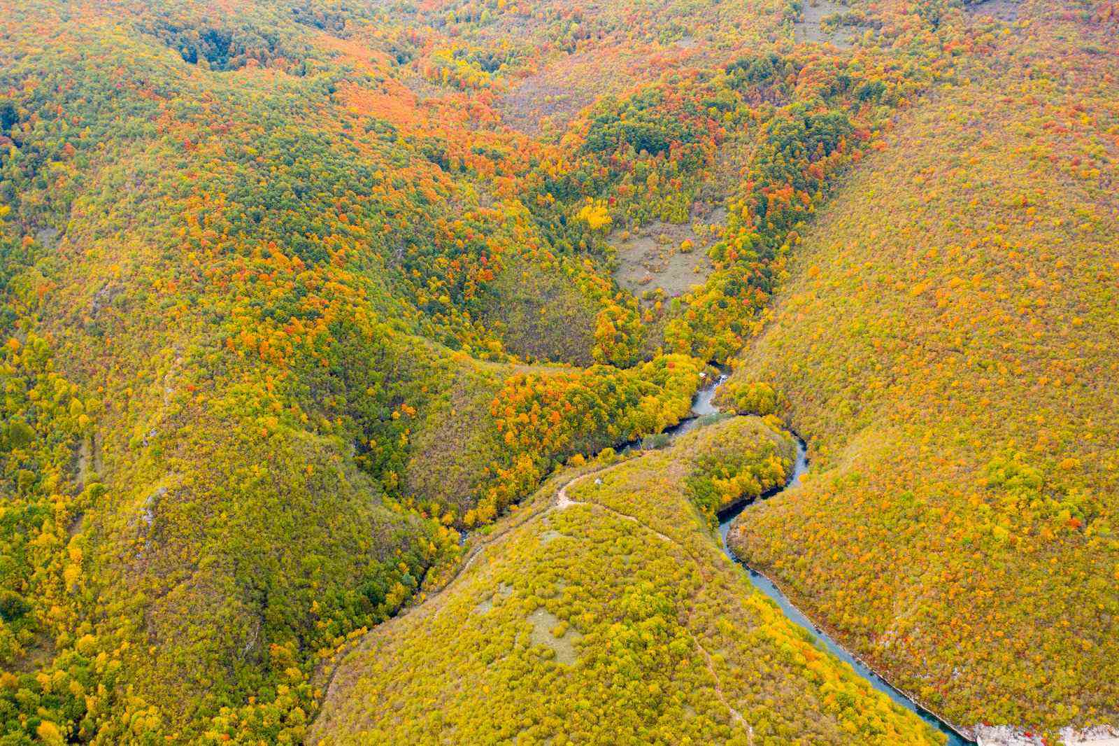
Forested hills and a river in autumn colour above Pecka, from the air

TRAILS & CYCLING · VISITOR CENTER PECKA

The trails startat the door

In Pecka you don't have to go far to be deep in nature. Around the village there are 200+ km of marked hiking and cycling trails, linked into a wider 300+ km network across the Mrkonjić Grad region — through forests of fir, spruce, pine and beech, past springs, pastures and old village roads.

Pecka is a handy base — you sleep in the heart of the village, and the trails run out from Pecka and the country around it.

200+ km
of cycling trails around Pecka
100 km
of hiking, GPS-mapped
300+ km
wider Mrkonjić Grad network
0 km
to the start — right outside

Quick facts

The network around Pecka, at a glance

What you check before packing the bike or the boots.

Cycling trails
200+ kmwaymarked around Pecka, asphalt and gravel
Hiking trails
≈100 kmGPS-mapped and waymarked
Wider network
300+ kmacross the Mrkonjić Grad region
Difficulty
4/10 – 9/10from a family loop to full-day tours
Via Dinarica
On the routeinfo boards and signage at the centre
Bike
Bring your owndownload the GPX below
Base
Visitor Centera bed before and after the ride

The network

Three numbers, three different scopes

Three figures circulate about Pecka and all three are correct — they simply describe different extents. That is why they are kept apart here, and never added together.

≈100 km

Hiking trails

GPS-mapped and waymarked around Pecka.

EU4Business mapping

200+ km

Cycling trails around Pecka

Mapped and waymarked by the Greenways association.

Greenways

300+ km

Wider Mrkonjić Grad network

Asphalt and gravel roads beyond the village itself.

Green Tour

0100200300

The figures nest: the hiking network sits inside the cycling one, and both sit inside the wider regional system.

Cycling

MTB and gravel in the country around Pecka

The country around Pecka is threaded with over 200 km of waymarked trails, mapped and signed by the Greenways association, as part of a wider 300+ km system of asphalt and gravel roads across the Mrkonjić Grad region. That is why this area has become one of Bosnia's favourite mountain-biking destinations in recent years.

Routes run from an easy 16 km family loop to demanding full-day tours of over 80 km and nearly 2,000 m of climbing — there is something here for casual riders and for serious cyclists. They link hilltop villages, springs and viewpoints.

Bring your own bike — the trails are out in the region, and Pecka is where you sleep.

  • gravel
  • asphalt
  • hilltop villages
  • viewpoints
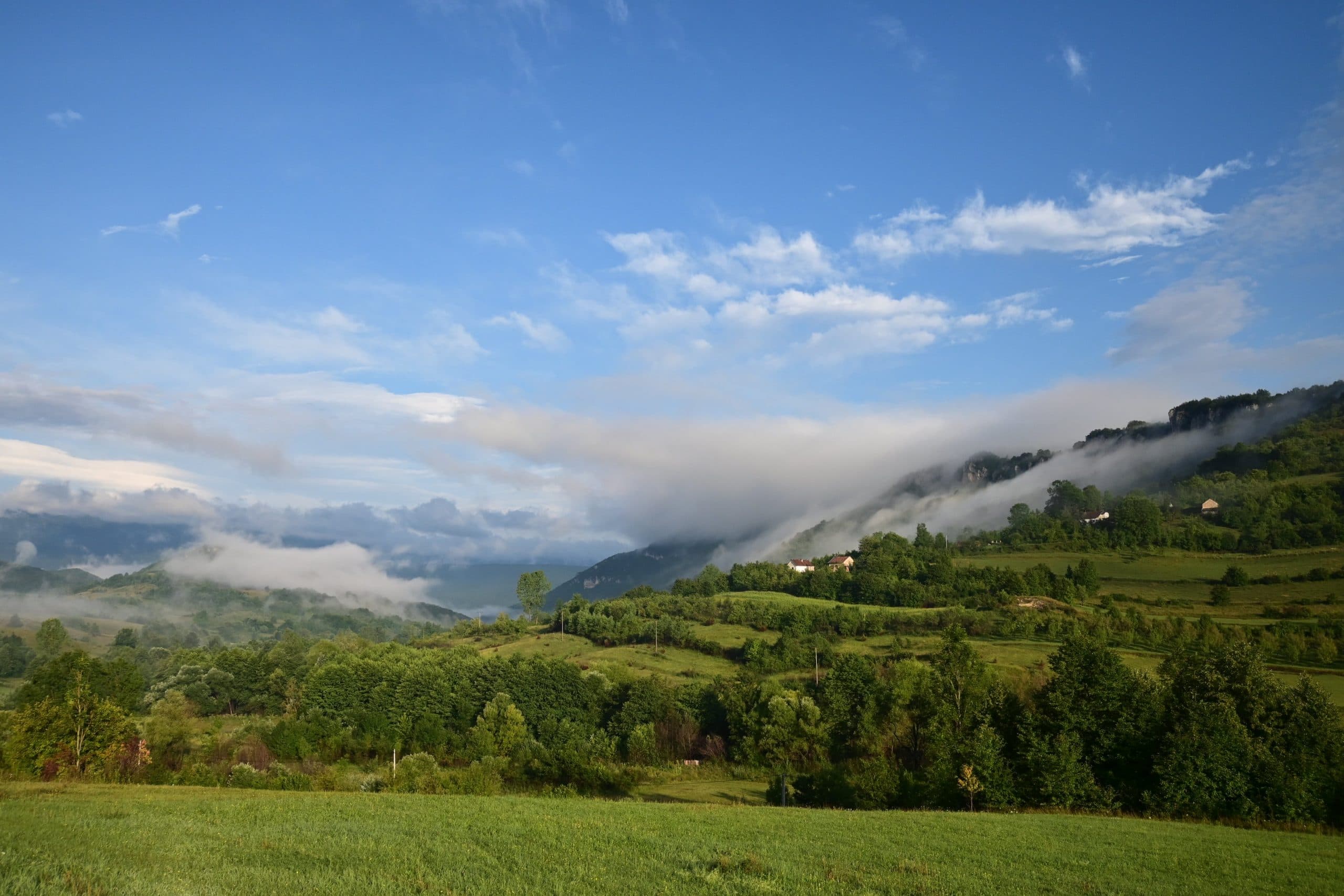
Hills and pastures above Pecka, the terrain the cycling trails cross

Cycling routes

Eleven routes, with GPX

Named tours across the wider region — from a family loop around Pecka to full-day rides over Vitorog. Each one carries an elevation profile drawn from its own GPS trace and a file you can drop straight into your navigation.

Difficulty
Sort

showing 11 of 11 routes

  • 02
    • loop
    • starts in Pecka

    The source of the Sana, around Pecka

    Pecka Centre

    easy, family-friendly

    416 mhighest point 675 m
    Distance
    16 km
    Elevation gain
    448 m
    Ride time
    2 h
    Difficulty4/10
    Technical4/10
    Surface
    asphalt + gravel + hiking path
    Bike type
    MTB / gravel
    Route description

    The village of Pecka and the springs of the Sana

    We set off in front of the Pecka Visitor Center towards the source of the Sana, dropping gently along a good asphalt village road. Take care — it is narrow, with thick vegetation on the verges in places, so drivers cannot see you in time. After 3.5 km of asphalt we come down onto hard gravel and keep descending, so more caution is needed. A little over a kilometre on there is a fountain that runs all year, and after it the gradient steepens as the descent continues. A few hundred metres later, follow the signs to a levelled area built of crushed stone, and from there carry on along a hiking path over grass and rock. Then comes a footbridge and a place to stop and rest. The springs and the water around you are beautiful and drinkable — take the chance to quench your thirst somewhere you will not find twice. After the break you return the same way, and that will take some strength and good will. Go back to the junction where the asphalt begins, and just before it turn right and continue on gravel. Then asphalt again, gentler climbs, and the high point of the route. You ride village roads in the pleasant shade of the trees, and at the 14th kilometre reach a point with a beautiful panoramic view — a chance for a photograph. Just over a kilometre remains, and you are ready for the next day and bigger undertakings.
  • 10
    • point to point

    Pribelja – Lipovača – Đukići – Todorići

    Pribelja → Todorići

    867 mhighest point 1497 m
    Distance
    32 km
    Elevation gain
    561 m
    Ride time
    2 h
    Difficulty4/10
    Technical4/10
    Surface
    gravel / meadow track
    Bike type
    MTB
    Route description

    Pribelja – Todorići

    This route is an important link between route 09 and routes 07 and 08. It is 32 kilometres long, starting at Pribelja — at the 21st km if you set off from Mliništa — and finishing at Todorići. If you are heading from Mliništa towards Janjske otoke, coming this way is the ideal combination. It is mostly an easy descent through forest and across meadows, on the lines Ćiro used to work. The route is not strenuous and has its charms as you move through the trees. Setting off from Mliništa it is 53 km to Todorići and 59 km to Janjske otoke.

  • 11
    • point to point

    Mliništa – Potoci – Srnetica – Drinić – Bosanski Petrovac

    Mliništa → Bosanski Petrovac

    656 mhighest point 1204 m
    Distance
    73 km
    Elevation gain
    1117 m
    Ride time
    6–7 h
    Difficulty5/10
    Technical4/10
    Surface
    gravel / asphalt
    Bike type
    MTB / gravel
    Route description

    Mliništa, Potoci, Drinić, Bosanski Petrovac

    One of the routes that can be ridden in both directions. Here we describe the Mliništa – Bosanski Petrovac direction, because we think it is the easier one to carry out and just as exciting. We recommend starting from the car park in front of the Mali raj restaurant and setting off along the line Ćiro took. For the first 16 kilometres, on a very gentle climb along a forest road, you ride surrounded by wilderness and silence. After that you descend some six kilometres at a slightly steeper gradient, then another six gently downhill. You climb on asphalt to Potoci — a chance to refill your water and freshen up before carrying on through the wild. For the next 22 kilometres you are on almost flat forest road, the continuation of Ćiro's line. Halfway along it you come to Srnetica, an abandoned town and once a great junction of railway lines. When the easy riding along Ćiro's lines comes to an end, you descend first to the hunting lodge and the Veliko vrelo restaurant, and after 7.5 km reach Drinić. From there an easy ten kilometres or so brings you into Bosanski Petrovac — a chance to rest and wait for transport, or stay the night if you like.

    NoteThis counts as a full-day route, so carry enough water, extra food, spare parts and basic tools. It is also worth following the forecast, and riding as a team is advisable because you pass through wilderness twice. On working days you may meet machinery and trucks carrying logs along the way.

  • 01
    • loop
    • starts in Pecka

    Pecka – Medna – Pecka

    Pecka Centre

    356 mhighest point 828 m
    Distance
    31 km
    Elevation gain
    902 m
    Ride time
    3–4 h
    Difficulty6/10
    Technical4/10
    Surface
    asphalt + gravel
    Bike type
    MTB / gravel
    Route description

    Pecka – Medna – Okandžije – Vrbljani – Sana – Pecka

    We set off in front of the Pecka Visitor Center towards Donji Baraći and soon turn for the village of Medna and Ubovića brdo. There is asphalt for a while, then gravel, with the climb alongside us the whole way — some 5.5 km of it. That brings us to the high point of the ride at 828 m, and on firm gravel we drop gently towards the Medna monastery and then the village of the same name. We rejoin asphalt, then come to the turn for the Church of the Nativity of the Mother of God, where there is a fountain of drinking water. We pass the hamlet of Božići and carry on along the Medljanska river to the village of Okandžije, where a small and lovely waterfall and an old watermill appear on the left. Following the Medljanska down, we reach its confluence with the Sana at Trivunov most and keep following the Sana upstream. On to the village of Donji Vrbljani and then Berići, where the gentle descent ends and a short gravel climb begins — demanding both technically and physically. We ride gravel through the hamlets, drop to the Sana, cross the bridge and keep climbing on gravel for 2.2 km. Then it is an easy asphalt run back to the Pecka Visitor Center.

    NoteThere are several springs and fountains along the way where you can refill your water.

  • 06
    • loop
    • starts in Pecka

    Pecka – Podovi – Pliva source – Gerzovo – Pecka

    Pecka Centre

    457 mhighest point 878 m
    Distance
    55 km
    Elevation gain
    1143 m
    Ride time
    ≈3 h
    Difficulty6/10
    Technical5/10
    Surface
    asphalt + gravel
    Bike type
    MTB / gravel
    Route description

    Pecka, the springs of the Pliva

    An ideal half-day loop across varied and beautiful terrain. Since it starts at the Pecka Visitor Center, a climb waits for you straight away — first gravel, then asphalt, where you join the M15 main road for part of it, so a little caution does not go amiss. The opening gives you some ten kilometres of climbing and about 400 m of height, so take it slowly; there is nowhere to rush, and you will reach the end without trouble. From the high point you descend to Dragnjić podovi, where a picturesque landscape and a flatter section wait. Near the end of the plateau you leave the asphalt for a slightly steeper drop along the former Ćiro line, and then the gradient eases. Along the way there are several points with a beautiful view over the Pliva valley, and a rare chance to photograph the panorama. The descent runs about ten kilometres. When you have come down the gravel section, you reach the asphalt road on the Pliva's left bank, which carries you six kilometres to the springs. You return the same way, following asphalt all the way to the turn for Donji Baraći, which is your direction. There a climb of 12 kilometres waits, with the gradient changing constantly. At the end it is about five kilometres down to the Pecka Visitor Center. Time for a good meal as a reward, and something cold with it.

  • 07
    • loop

    Janjske otoke – Šipovo – Stanica – Kozila – Strojice – Janjske otoke

    Janjske otoke

    441 mhighest point 935 m
    Distance
    46 km
    Elevation gain
    1056 m
    Ride time
    3–4 h
    Difficulty6/10
    Technical3/10
    Surface
    asphalt + gravel + meadow track
    Bike type
    MTB / gravel
    Route description

    Janjske otoke, Šipovo, Kozila, Popuže, Strojice

    A loop in the Šipovo municipality that makes for uniquely enjoyable riding. It sets off from Janjske otoke towards Šipovo and it is all gentle descent, so your legs warm up easily and you have already covered ten kilometres. From there you can add another twelve and go out to the springs of the Pliva; if not, you start climbing towards Donji Baraći for the next ten kilometres or so, gaining 530 m. After that you ride across the beautiful Kozila plateau, then a little more climbing towards the villages of Popuže and Đukići in the direction of Todorići and Strojice, where you come out on the Šipovo – Kupres regional road. At Strojice there is a chance to try Pletenica cheese, which has no equal in Bosnia and Herzegovina. After a bite of it you carry on towards Šipovo for the next 7 kilometres, descending to Janjske otoke — an ideal place to try some home cooking after a good ride.

  • 03
    • loop
    • starts in Pecka

    Pecka – Pliva source – Šipovo – Jajce

    Pecka Centre

    53 km short version

    363 mhighest point 772 m
    Distance
    96 km
    Elevation gain
    1565 m
    Ride time
    5–6 h
    Difficulty7/10
    Technical3/10
    Surface
    asphalt + gravel + hiking path
    Bike type
    MTB / gravel / road
    Route description

    Pecka Visitor Center, the springs of the Pliva, Šipovo, Jezero, Jajce

    Given how it can be combined, this route could be called three in one. You can ride only to the springs of the Pliva and back, which is 44 km; you can ride all the way to the town of Jajce, which is 53 km; or you can ride the complete route of 96 km. Here we describe the two longest options. It starts at the Pecka Visitor Center, gently uphill to Donji Baraći, and soon after them we turn towards Šipovo. There is almost six kilometres of climbing right at the start, so an easy pace is advised until you warm up. After the climb the terrain is mostly downhill with a few small rises, on a road that carries little traffic. We leave the regional road towards the village of Pljeva, that is, towards the springs of the Pliva. Following the river, after six kilometres you reach a beautiful hamlet and the Pliva's two main springs — an ideal place for a short break. Once refreshed, you return the same way, but now following the river downstream all the way to Jajce. At the 30th kilometre you reach Šipovo, and after a short break you can carry on towards Jezero and Jajce. A kilometre and a half past Šipovo a small yellow suspension bridge appears on the right; cross it to the Pliva's right bank and continue on asphalt and soon on gravel. Along the way there are several places to swim in the Pliva, and lake Đol, which is warmer than the river. Soon you reach Jezero, where the Pliva lake begins to form, and you follow it along the line the old Ćiro railway took. At the end of the gravel road there is a partly lit tunnel 200 metres long. Through it, turn left over the small bridge and the pedestrian zone by the bathing area on Pliva lake. Among the sights along the way are the little mills on the Pliva, declared a national monument of Bosnia and Herzegovina in 2009. After the Great and Little Pliva lakes the route follows the river all the way to Jajce. Here, after 53 km, your ride can end and you can arrange transport back or stay the night in Jajce — or you can ride back to the start. In that case we suggest returning up the Pliva and then continuing on the M5 main road. At Jezero turn for Šipovo, and after Šipovo take the turn for Donji Baraći, and you are soon at the Pecka Visitor Center, where you should treat yourself to a hearty meal and something cold.

    NoteSince this route uses regional and main roads, respect all traffic rules and ride in small groups, single file if there are several of you.

  • 08
    • loop

    Janjske otoke – Grbavica – Natpolje – Ljusa – Todorići – Janjske otoke

    Janjske otoke

    541 mhighest point 1133 m
    Distance
    60 km
    Elevation gain
    1694 m
    Ride time
    4–5 h
    Difficulty7/10
    Technical4/10
    Surface
    gravel + asphalt
    Bike type
    MTB / gravel
    Route description

    Janjske otoke, Gorica, Natpolje, Ljuša, Todorići

    One of the finer routes: a challenge to your fitness, and as the reward a beautiful landscape and the silence of the forest. You set off from Janjske otoke on a fairly hard climb, and if you are not warmed up or in form you can walk the start of it. The steep part runs 3.5 kilometres and gains 350 m. After a short gravel descent you keep climbing gently for about seven kilometres until you reach the line where the narrow-gauge railway and Ćiro used to run. From there the climb carries on, but very gently — over the next 22 kilometres you gain 700 m. The surroundings are beautiful: deep forest, shade, and several springs and fountains along the way where you should certainly refill your water. At the 34th kilometre the descent finally begins and runs for 14 kilometres, but do not be fooled, it is not over: ahead is the last check of your fitness and your resolve. For four kilometres there is a climb on asphalt all the way to Todorići and Strojice. Since you have arrived at the place where you can buy the best-known cheese in the wider region — Pletenica, the Bosnian scamorza — take the chance, because all that is left is 6.5 kilometres of descent on the main road and you are back at the start. Time for a rest and something cold.

    NoteIn the area between Natpolje and Ljuša you will notice a certain amount of bear scat on the route. Do not be alarmed — encounters are very rare. We recommend riding in groups anyway, because it is nicer and more cheerful.

  • 09
    • loop

    Mliništa – Vitorog

    Mliništa (Mali raj restaurant)

    highest point: Vitorog, 1,868 m

    1108 mhighest point 1868 m
    Distance
    64 km
    Elevation gain
    1114 m
    Ride time
    4–5 h
    Difficulty7/10
    Technical6/10
    Surface
    gravel
    Bike type
    MTB
    Route description

    Mliništa, the summit of Vitorog

    This is one of the highest routes on the list. The start is at 1,136 m and the high point is 1,868 m. It sets off from the Mali raj restaurant and lodging, towards the summit of Vitorog. The whole way is gravel of varying quality, so a mountain bike is recommended. The opening is ideal for warming up — almost ten kilometres on flat gravel — and then the first climb of two kilometres at a steeper gradient. After that a climb of about ten kilometres of medium difficulty continues, then a rest again on flatter gravel for some five kilometres. For the finish, a test of strength and endurance: a climb of almost seven kilometres gaining 440 metres. You have reached the summit. A break and something refreshing, with a beautiful view over everything around you. Then you return the same way, descending to the start.

    NoteYou are in wild country and surrounded by silence. We recommend riding in groups, so it is more fun and you can support one another. Bring enough water, and if it is a sunny day, protect yourself from the sun.

  • 04
    • point to point
    • finishes in Pecka

    Ključ – Ribnik – Medna – Štrbina – Pecka

    Ključ → Pecka Centre

    252 mhighest point 936 m
    Distance
    57 km
    Elevation gain
    1715 m
    Ride time
    5–6 h
    Difficulty8/10
    Technical3/10
    Surface
    asphalt + gravel
    Bike type
    gravel / road / MTB
    Route description

    Ključ, Ribnik, Vrbljani, Medna, Pecka

    This is one of the routes that can be ridden in both directions; this description follows Ključ – Pecka. The intention from the outset was to keep you off main roads as much as possible, so the route from Ključ can be ridden its whole length on a road bike. The GPX file, though, describes a version that runs partly on gravel, which a gravel, mountain or trekking bike will handle. On a road bike, take the M5 from the start — Ključ – Mrkonjić Grad – Jajce — and after the village of Velečevo turn right for Ribnik, where you join this route. The opening is easy and ideal for warming up. We follow the right bank of the Sana towards Ribnik and after a little under four kilometres cross the bridge over the river, continuing on a village road until we come out on the main road and turn right for Ribnik. A little under two kilometres later we turn right onto a village road, cross the Sana again and carry on through Gornji Ribnik all the way to Ribnik. An ideal place for a short break by the river of the same name, and to prepare for a climb of 8.5 km and around 500 m of height. Over the first pass we drop into the village of Vrbljani, down to the Sana. We cross the river and follow the Medljanska, where another climb begins — this time 13 kilometres and 700 m of height. At the Štrbina pass there is another in the series of springs and fountains, before an easy 12-kilometre descent all the way to the Pecka Visitor Center.

    NoteThis route can be combined with route 1: at the village of Vrbljani you can head straight for the springs of the Sana and the village of Pecka, which shortens the ride by 16 km and 850 m of climbing.

  • 05
    • loop
    • starts in Pecka

    Pecka – Jasenovi potoci – Mliništa – Potoci – Busije – Vrbljani – Pecka

    Pecka Centre

    the hardest

    369 mhighest point 1204 m
    Distance
    80 km
    Elevation gain
    1947 m
    Ride time
    5–6 h
    Difficulty9/10
    Technical5/10
    Surface
    asphalt + gravel
    Bike type
    MTB / gravel
    Route description

    Pecka, Mliništa, Potoci

    Another loop — physically demanding and superb — that will give you beautiful country, test your endurance and leave you alone with nature. We recommend not riding this one by yourself, because for about 30 kilometres you are a long way from anything. A charged phone, spare parts and a look at the forecast are an obligatory part of the preparation. It sets off from Pecka towards Jasenovi potoci, and the opening climb runs 14 kilometres and gains 670 metres. Start gently, and make your first long break at Mliništa, where there is a restaurant to refuel in. Once you have seen what is left of the old Ćiro train and recharged, you enter deep forest along the line Ćiro ran. Around you there will be nothing but trees and wild animals. The gradient is only 1%, so the going is easy, in shade, on ground that is often firm and sometimes loose. A rare chance to enjoy the silence nature gives you. After 30 kilometres you begin the descent to Potoci, an inhabited place but with few people in it. There you move from gravel to asphalt, and after Potoci you return on asphalt towards the village of Busije. You drop into a beautiful valley, and ahead is another climb of four kilometres, then six kilometres down, then a kilometre up and a further 6.5 kilometres down. To reach the Pecka Visitor Center you still have 3 km of harder climbing across the Sana — the last test of your endurance and of how much you want to get back to where you started, to the local cooking and something cold. After a route like this you can be proud of your fitness, and you genuinely do love riding a bike.

    NoteIn the forest you may meet various wild animals, which are always afraid of people and try to hide. In rare cases you may meet a brown bear, but if you are in a group and making a moderate amount of noise the bear will watch you from a respectful distance.

Hiking & mountaineering

A hundred kilometres underfoot

Around 100 km of GPS-mapped hiking trails surround Pecka. The most popular is the walk to the Sana springs, along with the trail through the Korana canyon and shorter loops to viewpoints and through the forest around the village.

For bigger objectives, the wider region has real mountain peaks — Lisina, Dimitor and Čemernica — about an hour's drive from Pecka.

Peaks in the wider region

  • Lisina
  • Dimitor
  • Čemernica

≈1 h drive from Pecka

Guide to the Sana springs
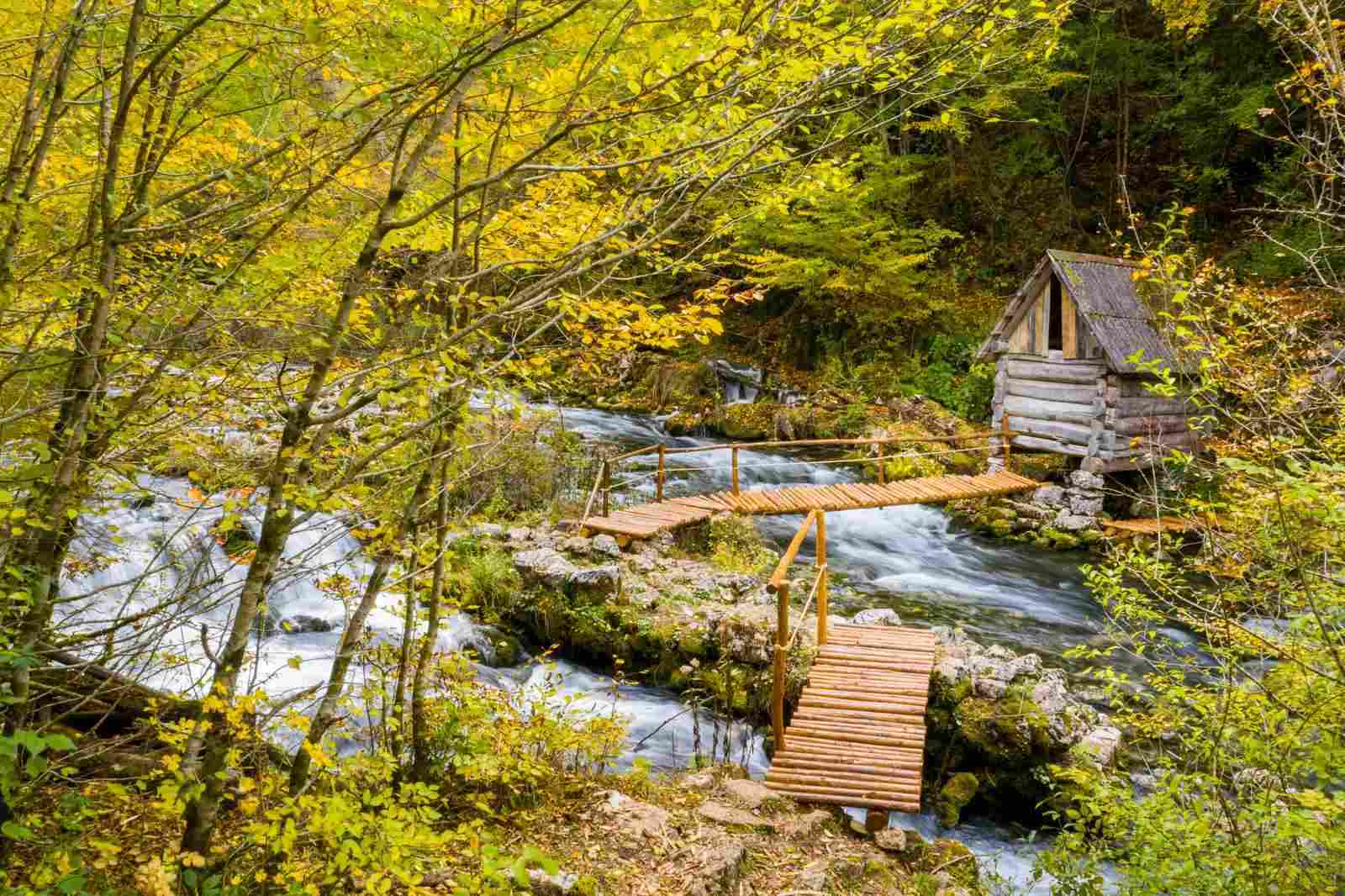
Wooden boardwalks and an old mill on the waymarked trail through the Korana canyon

Via Dinarica

Pecka sits on the route

  • info boards on site
  • a leg or a base
  • on foot and by bike

Via Dinarica is the network of hiking and cycling trails through the Dinaric Alps that National Geographic ranked among the world's top trekking destinations. The centre has info boards for the routes across Bosnia and Herzegovina, making Pecka a natural base for a leg or for prepping a multi-day trip.

Among the world's top trekking destinations.
National Geographic, on Via Dinarica

Where the trails lead

What you can reach

From Pecka, on foot or by bike. Distances are approximate, measured from the Visitor Center.

Visitor Center Pecka

Nature en route

Forest, water and birds

The trails cross one of Bosnia's most water-rich areas — old forests laced with mountain streams. The region is rich in birdlife too: golden eagles and owls once nested here, which makes Pecka of interest for birdwatching as well.

Forests you ride and walk through

  • fir
  • spruce
  • pine
  • beech

Protected species

  • golden eagle
  • owls

Guided birdwatching — on request and seasonal, being confirmed with the centre.

Pecka as a base

A bed before and after the ride

The Visitor Center does not run tours and does not rent equipment — but it is a handy place to sleep before and after a day on the trails. Download a route GPX below and go; for conditions on the ground — weather, whether a track is passable — ask at the centre.

See accommodation

Still to come

  • An interactive trail map — in preparation

Until then, ask locally about routes — the hosts and the riders who know these trails can tell you what is passable and in what weather.

Who the trails are for

Families and casual riders

Easy routes and short outings, through forest and past springs.

MTB and gravel riders

11 routes, from 4/10 to 9/10 in difficulty.

Hikers and trekkers

Via Dinarica and the peaks of the wider region.

Code of conduct

Seven rules of mountain biking

The routes run through villages, pasture and private land. The code is the same on all of them.

Have a pleasant and safe ride!

  1. 01

    Ride only on open trails

    Respect closed roads and trails. Do not cross private land without permission.

  2. 02

    Leave no trace

    Be mindful of the ground under your wheels and ride with the smallest possible impact on the trail. Always close gates and yard doors behind you if you pass through someone's land, or leave them exactly as you found them.

  3. 03

    Keep control of your bike

    A moment of inattention can cause trouble. Respect every rule and recommendation on speed and riding for cyclists. Do not ride too fast.

  4. 04

    Look after the environment

    Take your rubbish out with you and do not damage the plants or the wildlife. Do not startle livestock — wait for the animals to move off the road themselves.

  5. 05

    Always give way

    Announce yourself in good time. A friendly greeting or a bell is a good gesture and can prevent accidents. Do not startle people as you pass, and always give way to walkers.

  6. 06

    Plan ahead

    Know your equipment, your own ability and the country you are riding through — prepare everything you need. Do not count on others; try to be ready for anything yourself. Always wear a helmet and proper protective gear.

  7. 07

    Get ready for the ride

    To enjoy the ride in comfort and freedom, prepare according to how long you will be out and how far into uninhabited country you are going. Carry basic tools, enough water and food, and spare clothing.

Best time and the rules

When to go, and how to behave

Spring and autumn
Ideal for walking and riding — comfortable temperatures and colour.
Summer
Good for the higher ground and for early or late rides.
Winter
The trails are quieter, and passability depends on the weather.

Trail etiquette

  • Carry your waste — and anyone else's — back out with you.
  • Stay on the waymarked trails.
  • Respect the hosts, the pastures and the animals.

Part of the region is protected nature — leave the beauty for those who come after you.

FAQ

Frequently asked questions

How much trail is there around Pecka?

Over 200 km of waymarked cycling trails around the village and about 100 km of hiking trails, as part of a network of over 300 km across the Mrkonjić Grad region.

Are the trails hard?

There is everything here: from an easy 16 km family loop to demanding routes of 80–96 km with a lot of climbing. Every route carries a difficulty rating (x/10) and an elevation profile.

Do I need my own bike?

Yes — bring your own bike. You can ask at the centre about routes and conditions, but the centre is not a rental.

Does Via Dinarica pass through Pecka?

Yes — the centre sits on the Via Dinarica route and has info boards for the routes across Bosnia and Herzegovina.

Are there GPX files and a map?

Yes — GPX files are available to download with each of the 11 routes. An interactive map is in preparation.

What can I reach from the trails?

The Sana springs, the Korana canyon, the Ubovića brdo viewpoint and the crag — and further out, Zelenkovac and the Pliva springs.

The trails are waiting.

Sleep at the start and set off in the morning, while the forest is still quiet.