Shortest
By gravel road
The shortest and most passable route toward the springs. By car you can continue for about another 2 km to the parking area, from where an approximately 800 m footpath leads to the springs.
SANA SPRINGS NATURAL MONUMENT · WESTERN BOSNIA
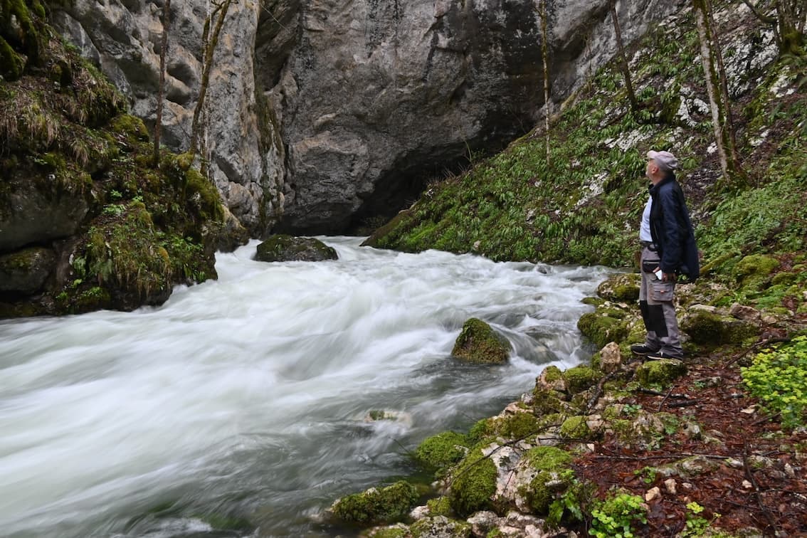
High in the hills above Pecka, the Sana River doesn't trickle into being — it arrives all at once. Three powerful karst springs rise straight out of the limestone, already a river.
This guide does one thing: it tells you exactly what to expect before you set out — how to get there, how long it takes, where to park, what to bring, when it's most beautiful, and how to behave in a protected area.
Quick facts
The three springs
The Sana is born not from one source but from three strong karst springs, at their most powerful in spring when meltwater fills the limestone massif. The water runs clear and cold year-round, and the surroundings — a cave, a waterfall and a "dry spring" that only comes alive at high water — give the place a feeling of untouched wilderness.
The springs sit in genuine wilderness and can only be reached on foot; for the last kilometre there is nothing but a footpath. That is exactly what keeps them pristine — no parking by the water, no crowds, just a river beginning in front of you.
three springs · one river
The Mračaj estavelle
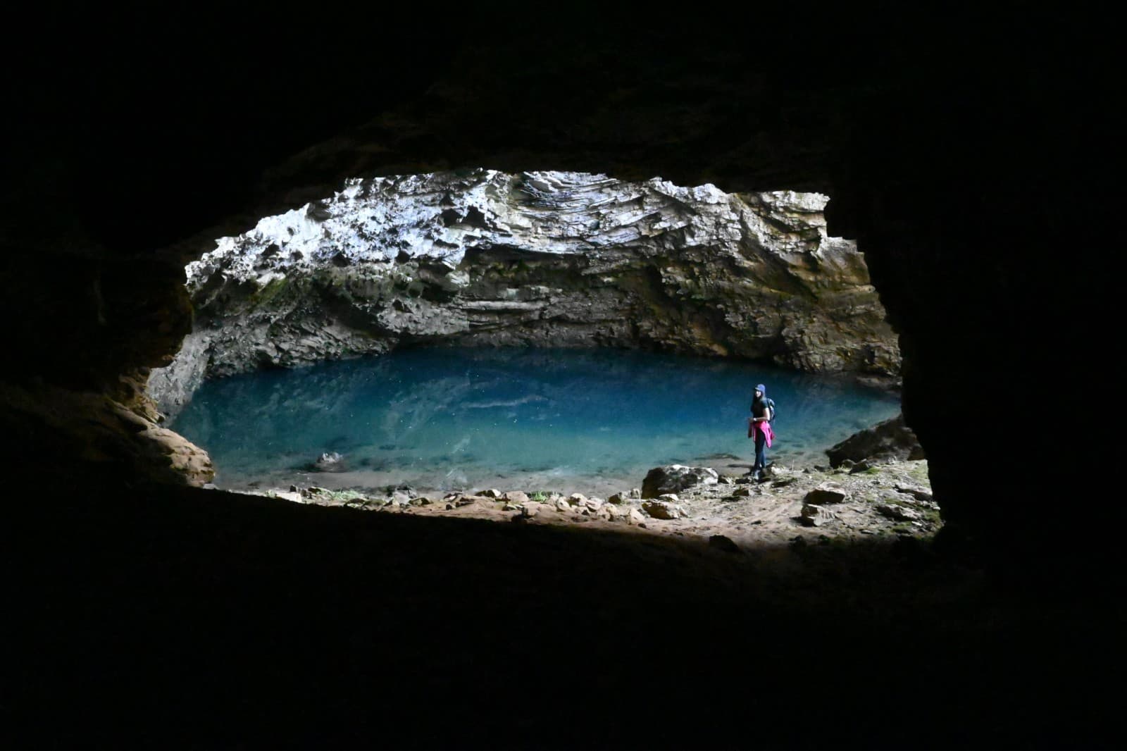
Near the springs lies Mračaj, one of the region's most intriguing hydrological features. An estavelle is a point that acts as a spring or as a swallow-hole depending on the groundwater level. Its underwater passages draw cave divers from around the world.
On the classic route to the springs, Mračaj usually comes first — then the trail continues to the three springs of the Sana.
~450 m
cave length
~26 m
depth
For visitors, Mračaj is a viewpoint and interpretation stop — not a place to enter or dive without expert guidance.
The Korana canyon
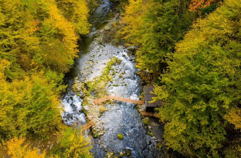
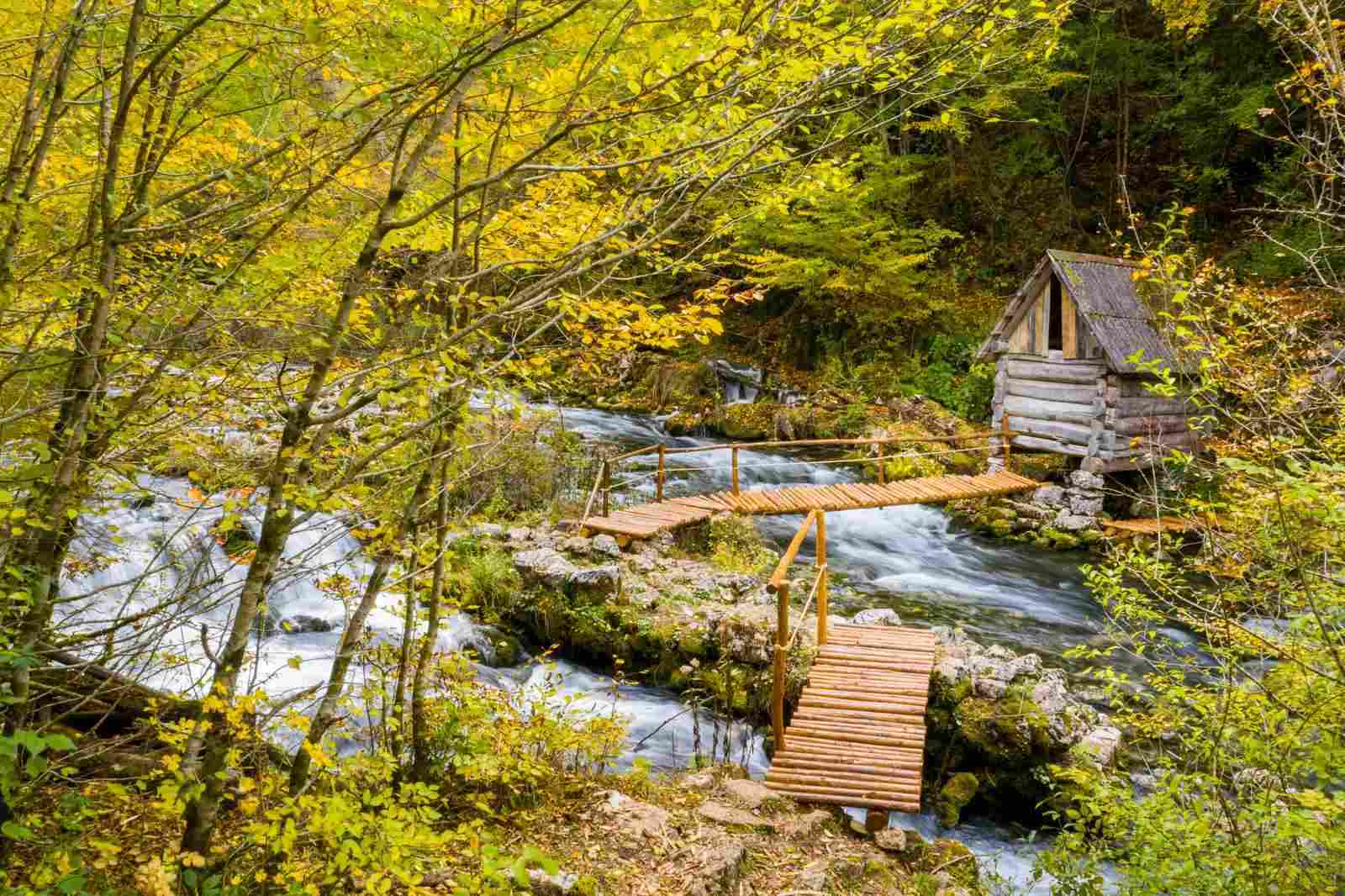
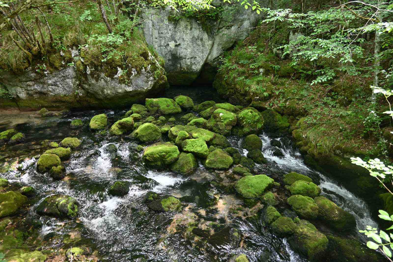
The lower Korana, a tributary of the Sana, runs through the same protected area and is one of its most beautiful parts. A marked trail about 3 km long follows the canyon — suitable for hiking, and for canyoning in the right water conditions.
Long hidden, the path was recently opened up through the "Green destination in the upper Pliva and Sana" project (EU4Business): it winds along a mossy, rocky course, making the canyon accessible to casual walkers, not just experienced explorers.
Canyoning through the Korana is a guided, technical activity — not an independent walk. Conditions depend on water and weather; confirm availability with the center.
Getting there
The Sana springs are about 6 km from Visitor Center Pecka, along two routes that share the same start.
1 km
Start in front of the old school — advice, a map and one last coffee before the trail.
2–3.5 km
The road leads through the village, past pastures, orchards and old stone and wooden houses. You can do this section by car or on foot. We recommend walking in spring, autumn or on cooler days, because in summer this section has little shade and can get very hot. Along the way you will pass several drinking-water springs and warm local households. The road is narrow, so drive and walk carefully.
Where the asphalt turns to gravel there is a signed junction. Here you choose one of two routes toward the Sana springs.
Shortest
The shortest and most passable route toward the springs. By car you can continue for about another 2 km to the parking area, from where an approximately 800 m footpath leads to the springs.
More beautiful
More beautiful, but more demanding. A longer route along the Korana River, past waterfalls, old watermills and wooden bridges. Ideal for those who want to experience nature, not just reach the destination.
final 1 km
Whichever route you choose, the springs themselves are reached only by footpath. Here every road ends and walking trails begin in the heart of the Nature Monument.
≈6 km
Three springs burst out of the limestone — the river begins in front of you.
Practical
Lower vehicles should park at the widening beside the road, where the gravel begins — beyond that, the terrain isn't for every car. Exact location and advice for larger vehicles will be confirmed by the center.
No mountaineering experience needed, but bring sturdy shoes and basic fitness — the terrain is gravel and rocky footpath. If you start from the Center, plan 3–5 h both ways, depending on fitness, preparedness and age. If you drive down to the parking area, the springs are about 10 minutes away. For children and dogs, ask the center for advice.
When to visit
The most striking season
The springs at their most powerful, nature at its most lush.
Colour and mild temperatures — a great choice for hiking.
Fine, but the trail has little shade — avoid the hottest days and carry plenty of water.
Conditions and access depend on the weather — check with the center.
Protected area
The Sana springs are a protected Natural Monument with level II and III protection regimes, so we treat them with respect:
Emergency number112
Stay on marked trails.
Carry out all waste — everything you bring in goes back with you.
No fires; don't damage plants, watermills, dry-stone walls or bridges.
Don't disturb wildlife or livestock on the pastures.
You walk at your own responsibility — carry a charged phone.
Nearby
Where to stay
The closest base for the springs is Visitor Center Pecka — sleep in the heart of the village and be first on the trail in the morning.
Check availability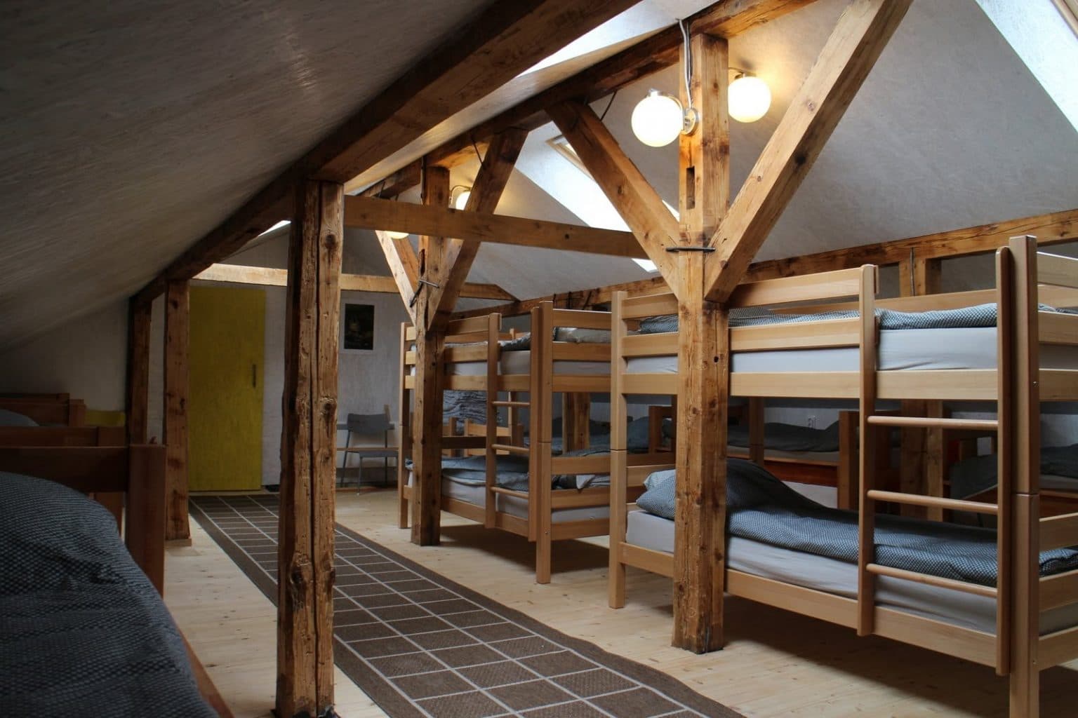
FAQ
About 6 km. The first 3 km through the village can be driven or walked; the final kilometre to the springs is on foot only.
Not all the way. You can drive the asphalt section through the village; then comes gravel, and the last stretch is footpath only.
Depending on fitness, preparedness and age, if you start from the Center plan 3–5 h both ways. If you drive down to the parking area, you can reach the springs in about 10 minutes.
The village section is easy; the final stretch depends on age and fitness. The center will gladly advise.
Spring (the strongest springs) and autumn (colour, mild temperatures). In summer, carry plenty of water — the trail has little shade.
A hydrological phenomenon near the springs: a point that is sometimes a spring, sometimes a sinkhole, depending on groundwater. The cave is ~450 m long and ~26 m deep.